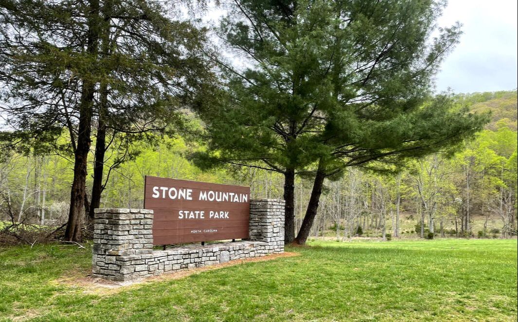
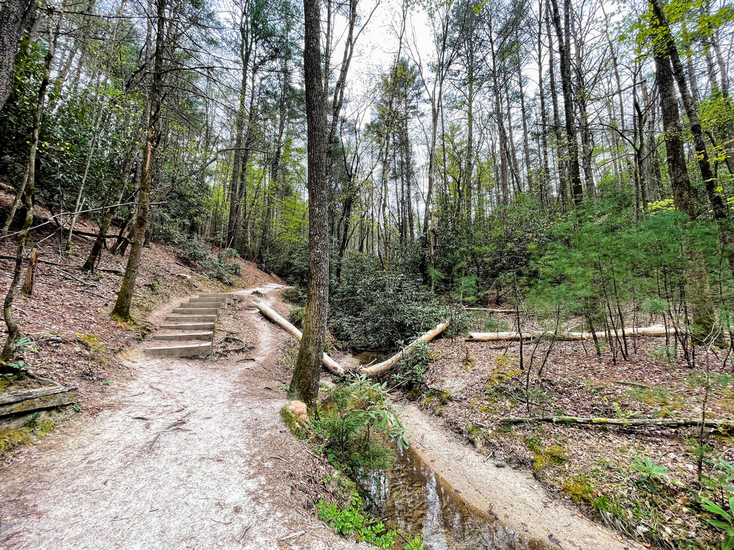
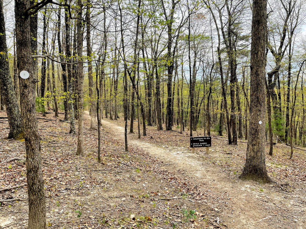
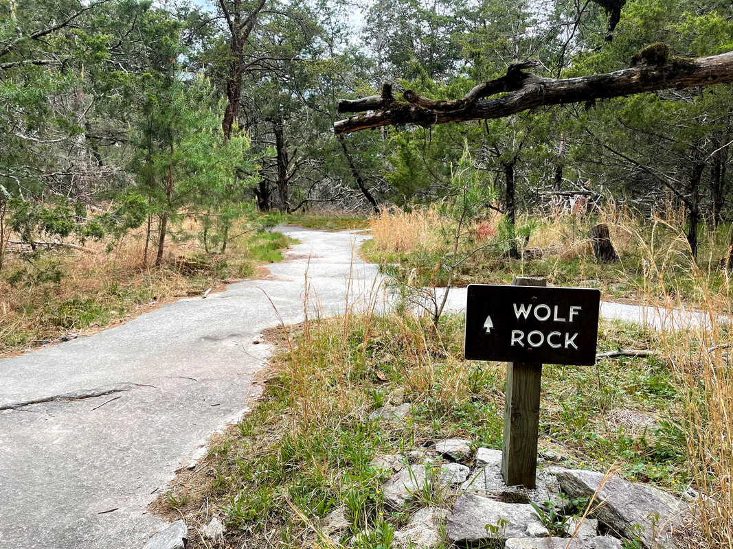
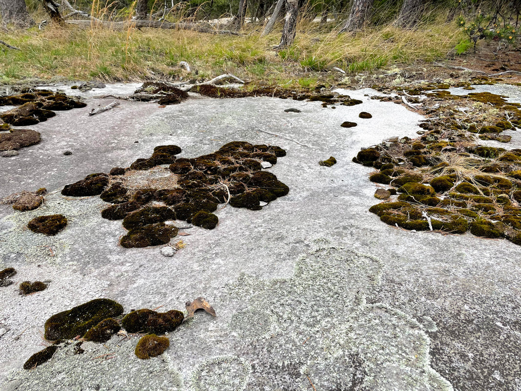
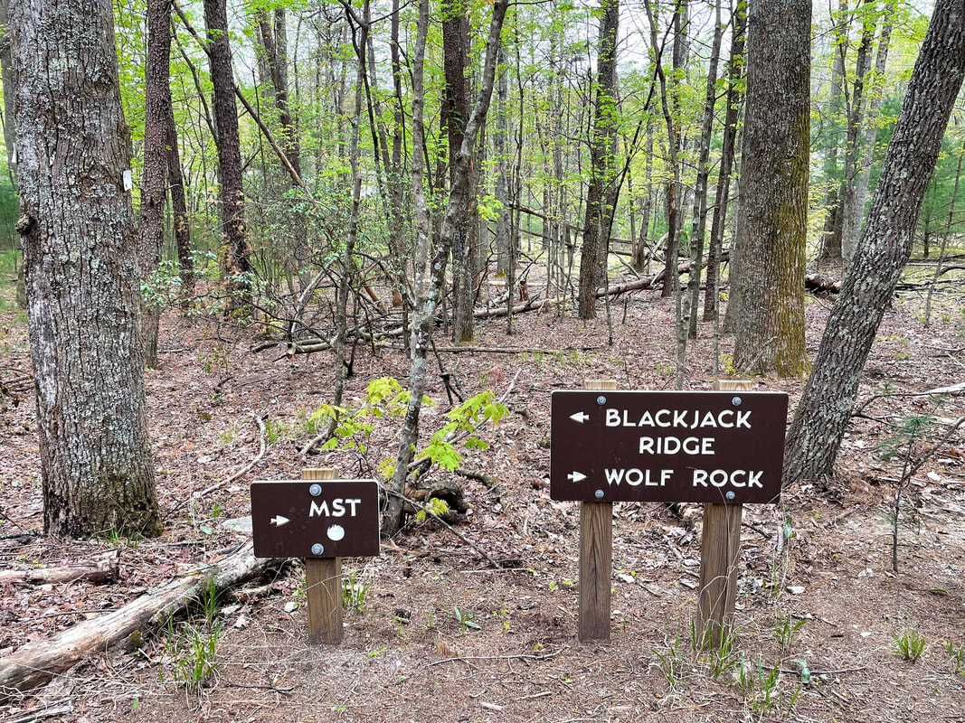
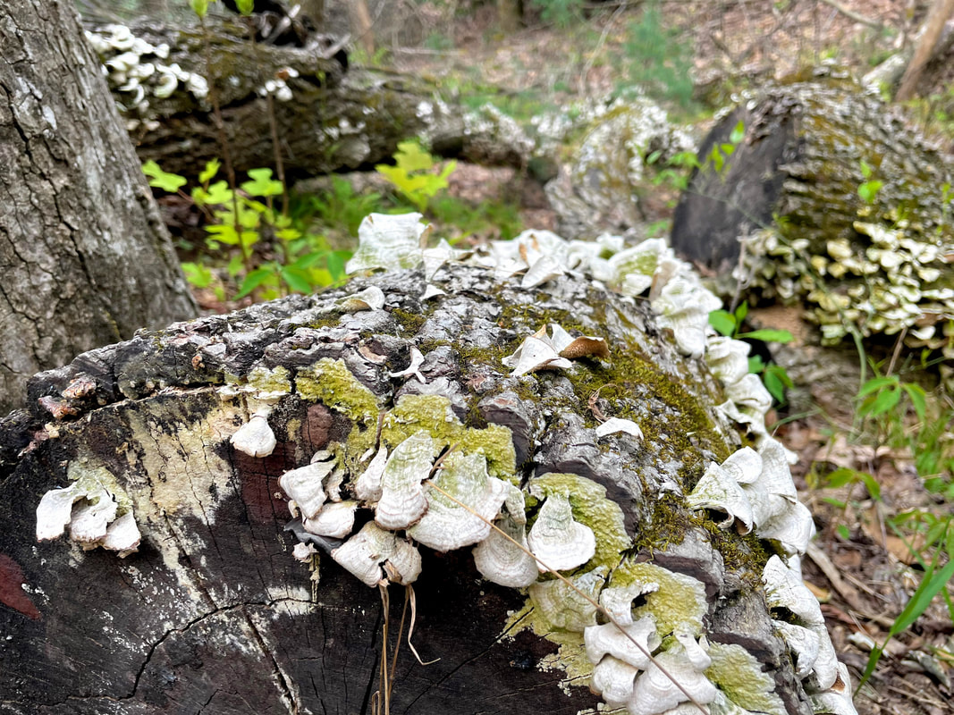
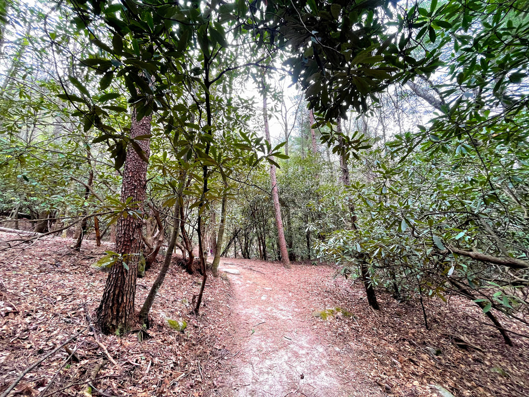
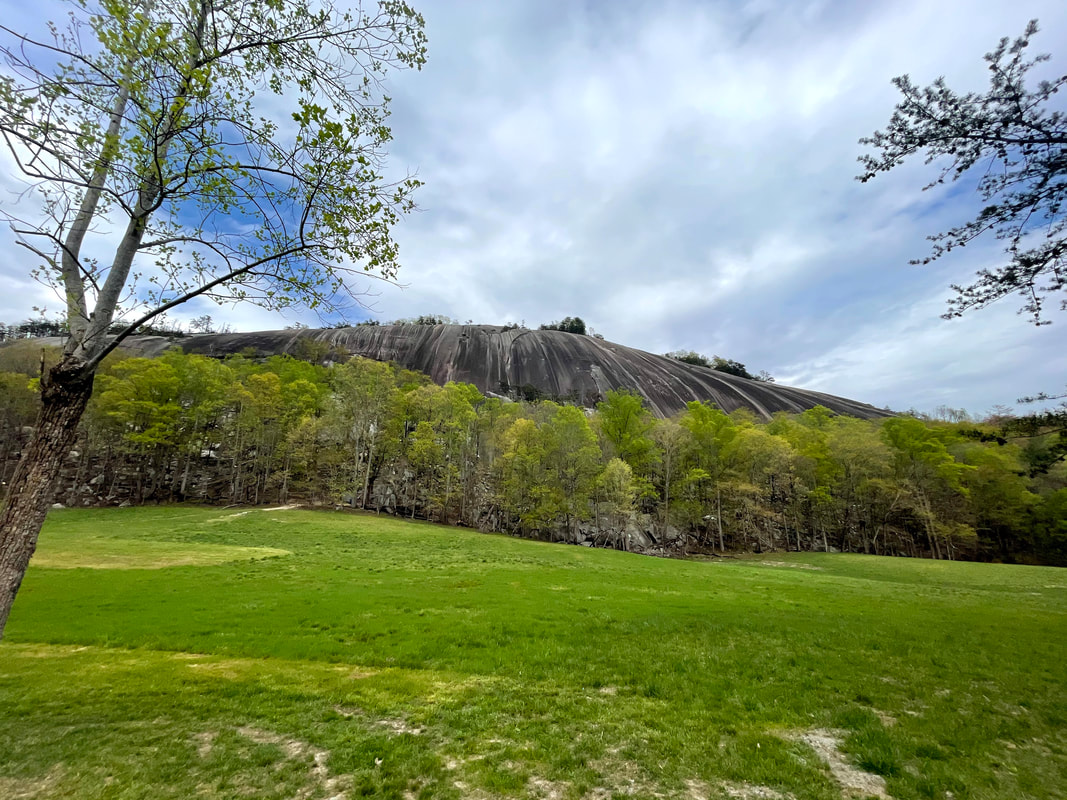
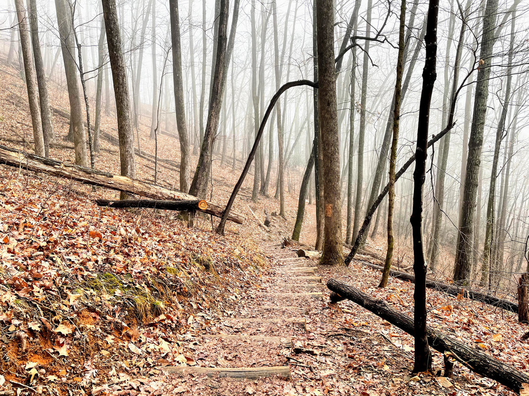
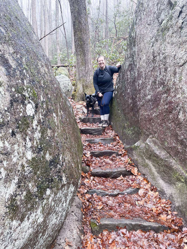
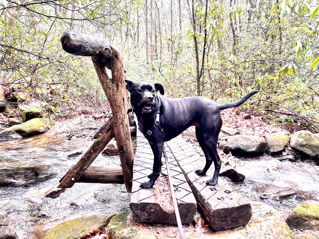
 Y'all. When I tell you I stumbled across a true hidden gem, I am not exaggerating. But before I get ahead of myself, let me back up. I have been wanting to visit Stone Mountain State Park for a hot minute now. Located just under two hours from my home in South Charlotte, North Carolina, Stone Mountain State Park presents the perfect day trip for those living in the Queen City. An easy drive up interstate 77, Stone Mountain offers scenic views, picture-perfect picnic spots, and even a little bit of history to be learned from the 19th century restored Hutchinson Homestead. From horseback riding to fishing, climbing to camping, visitors can do it all. The 600 foot granite dome that the park is named after offers a truly unique and impressive landmark. A 4.5 mile strenuous loop trail takes visitors past a large waterfall and ultimately to the summit of the dome. After deciding to visit Stone Mountain on a Saturday, and upon pulling into the lower trailhead parking lot and seeing that cars were parked in overflow areas, I knew it would be crowded. I also knew I had to pick a less popular trail. I like hiking and I like people (for the most part) but I don't like seeing (a lot of) people on my hikes. The Stone Mountain Loop Trail was out. After studying the map for a bit, I decided on the Wolf Rock Trail. 1.5 miles one way, this trail starts in the same place as the Stone Mountain Loop, but eventually tapers off on its own. After about a mile, you will come to an intersection with the Mountains-to-Sea (MST) State Trail. Keep going another half mile or so and the trail will start to flatten out, winding through a small thicket before opening up to what was not only a complete surprise but one of the best mountain views I've had on my hikes. Now, I'm sure if I had done a bit more research (guilty) I would have known this was part of the hike. However, the fact that I was not expecting this at all made it that much more amazing! Even more amazing was the fact that I had the whole rock to myself. A hiker's dream come true. Now, it was a big rock, and a few groups straggled through while I was up there, but none lingered. Maybe that was what was even more surprising to me. When I come across a view like that, I am going to stop and enjoy it. The others I came into contact with stopped, snapped a few pics, and kept on moving, but I'm not complaining. When I was finally ready to move on, I felt refreshed and full of energy. I kept going in the direction I had been heading, joining the Black Jack Ridge Trail, another 1.5 mile trail that would eventually connect to the Cedar Rock Trail, then back to the Stone Mountain Loop trail and back to the starting point, essentially creating my own loop totaling 4.64 miles. One thing I really loved was the diverse landscape and vegetation at various points throughout the trail. Going from lush rhododendrons and bubbling creeks to dry, rocky, hardwood patches was incredible. To summarize, I hiked a big old loop that was comparable in difficulty and distance as the Stone Mountain Loop Trail, had AMAZING views, and saw only a handful of others on the trail. People! This is the way to do it. And of course, if you were interested in a bit of a shorter hike, another option would be to take the Wolf Rock Trail back down after making it to the summit, for a 3.0 mile trip in total. I broke up my hike into two segments, the 1.5 miles to Wolf Rock, and then 3.2 miles from there back to the start. Read about the significance of the 3.2 miles in my last blog post here. 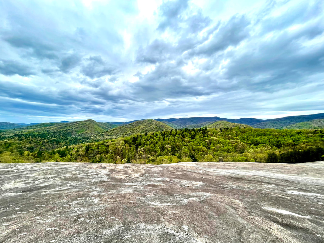 NEED TO KNOW: Park Address: 3042 Frank Parkway Roaring Gap, NC 28668 Park Hours: November - February: 7am - 6pm March, April, September & October: 7am - 8pm May - August: 7am - 9pm Closed Christmas Day Entrance Fee: None
1 Comment
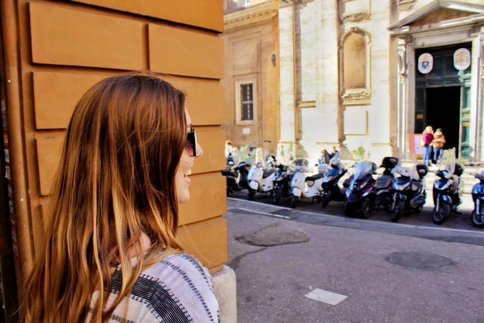
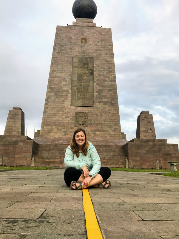
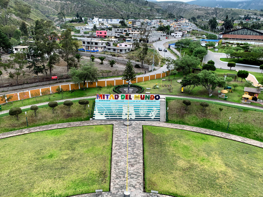
If you're familiar with the Outer Banks, North Carolina, or anything aviation-history related, you are probably aware of Jockey's Ridge (read my post about this amazing North Carolina State Park here). However, despite having vacationed in the Outer Banks for decades, we had never visited, much less even heard of this slightly smaller, but equally amazing natural area composed of just over 120 acres of sand dunes. Established in 1995, Run Hill State Natural Area exists just a few miles up the road from Jockey's Ridge to the north, and just south of the Wright Brothers National Memorial, which can actually be seen from the dunes on a clear day. With no visitor center, no designated parking lot, and no identifying information other than a somewhat obscured sign, Run Hill is certainly considered off the beaten path, which makes it so worth a visit. While we visited during the off season, you can bet that even during the busiest of summer months, you won't encounter many other people here. 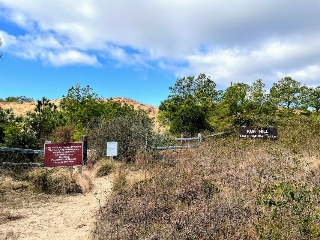 After parking and setting foot on the trail, you will be immediately greeted by a steep slope. It's short, but lots of loose sand can make getting up this little hill quite difficult. Once at the top, you will be able to spot the Wright Brothers Memorial. With no officially marked trails, you are free to wonder the area as desired. Along the way, you will encounter open spaces of sand dunes, deciduous trees, patches of ground cover and even some freshwater ponds. Keep an eye out for wildlife, including many bird species, turtles, snakes, raccoons, foxes, and more. Nags Head Woods Ecological Preserve is adjacent to the area, and stretches all the way to Jockey's Ridge, providing a continuous tract of natural land for plant and animal species in the area. With close to 2 million visitors a year at Jockey's Ridge, I guarantee you'll want to check out this spot that remains a secret amongst the locals. 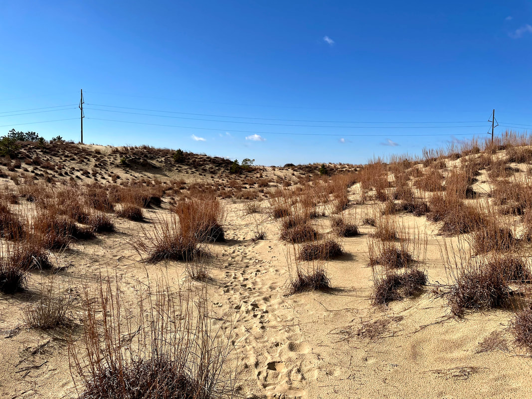 How to Get There: Located just behind First Flight Middle School, the area can be access by parking at the school and hiking towards the dunes. However, the easiest way to get there is to turn onto Landing Street from S. Croatan Highway. If you're coming from the south, turn left, and turn right if coming from the north. Drive to the end of Landing Street and turn right onto 10th Ave. At the end of the road is a small shoulder where you can park, across from the sign. Pro Tip: Because there are no designated paths or trail markers, it could be easy to get disoriented while you are exploring. Make a note of certain landmarks, such as the Wright Brothers Memorial or the large electrical lines that cross the middle of the dunes. The Memorial is located to the north and the lines run north to south. 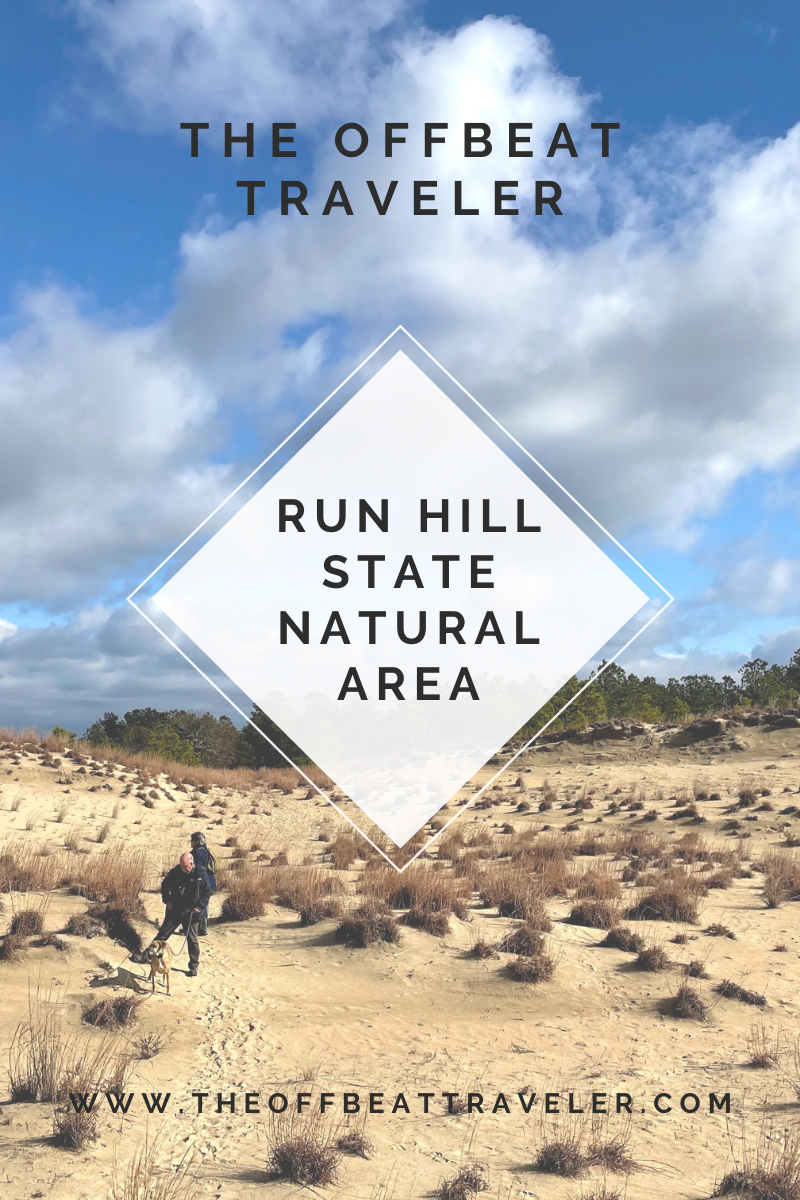 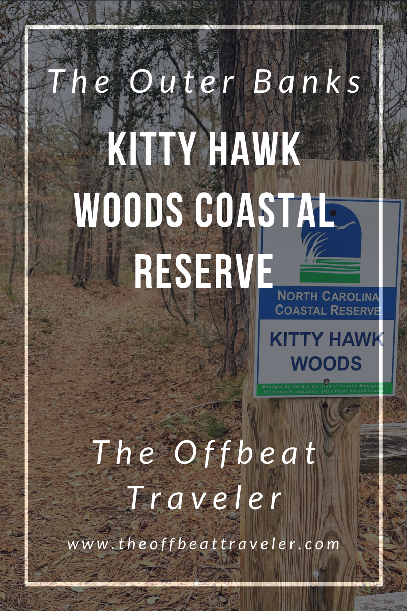 The Kitty Hawk Woods North Carolina Coastal Reserve, located in the town of Kitty Hawk in the Outer Banks, comprises over 1,800 acres of wooded area surrounded by the waters of the Currituck Sound to the west and the Kitty Hawk Bay to the south. As I mentioned in my last post about Jockey's Ridge, my family has been vacationing in the Outer Banks for decades. This is the first time we've visited the Coastal Reserve, and to be honest, we were (pleasantly) surprised at this find. Being from Virginia, we are well experienced with trails in the woods, and were shocked that there was such a large, heavily wooded area in the region. 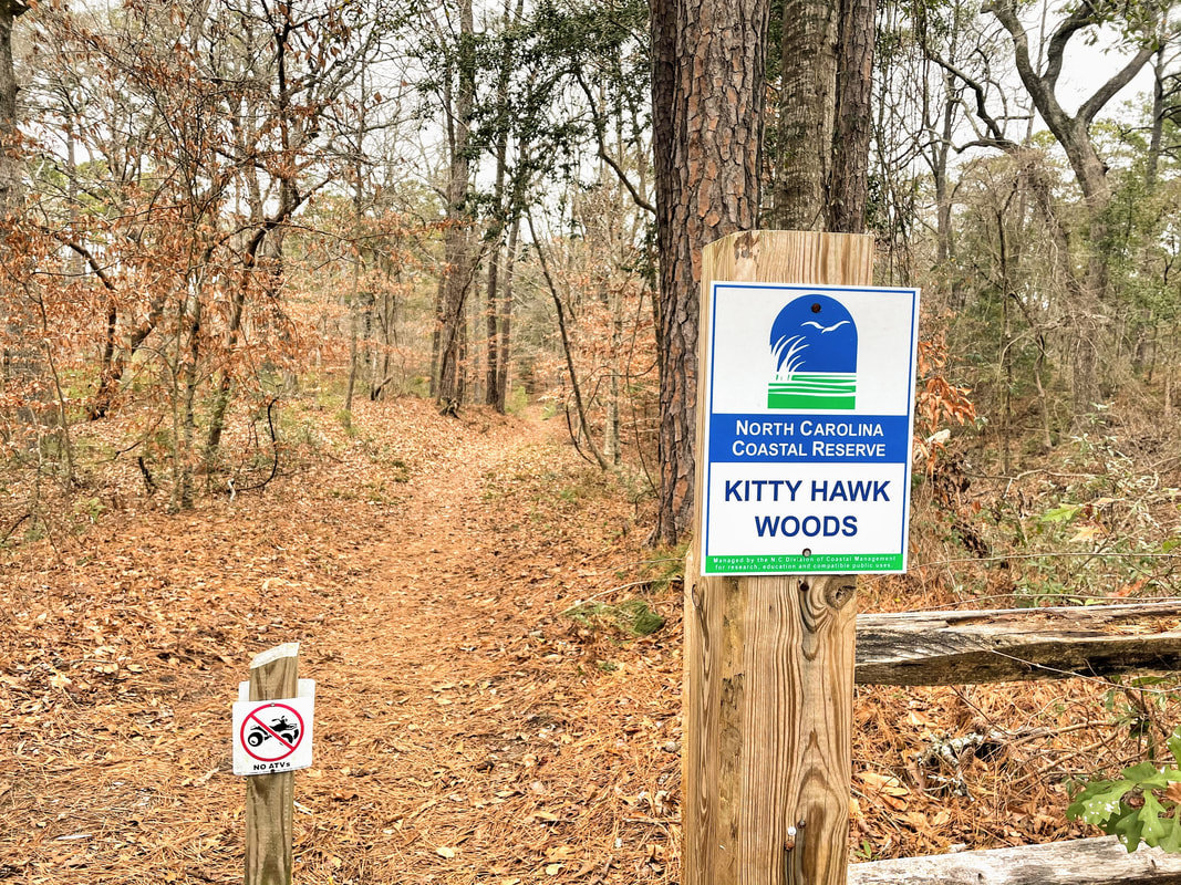 With hiking, biking, and even horse back riding trails, the woods offers activities for many outdoor enthusiasts. The trails are easy and would be perfect for families with small children, however it would be difficult for those with mobility issues due to muddy or flooded patches and thick ground cover. It's also important to note that there are private properties scattered throughout the area, as well as designated bow and gun hunting regions. I highly encourage a visit to the reserve. We decided to go on a cloudy, windy day and it turned out to be the perfect activity for the day as we were heavily shielded from the wind. I recommend downloading a copy of the reserve map to carry with you- while the trails are marked, there are some cross overs, as well as areas on paved road. Keep an eye out for the covered bridge- another happily received surprise that we never expected to find in the Banks. 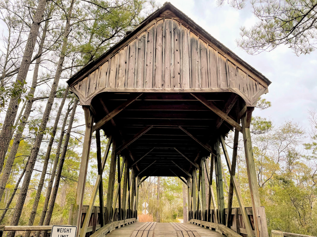  I've never not finished a hike before. Even the hardest, most uphill hikes. And I mean hardest; like the 17,000 foot Rainbow Mountain hike in Peru with limited oxygen and the requirement to bring an emergency horse cash fund in case you need to borrow a horse to get to the top. I didn't need a horse- I made it on my own two feet. That's why this felt especially insulting to me. A moderately-rated trail 4.3 mile trail with 1,200 feet in elevation gain and plenty of oxygen and I couldn't make it to the gem at the end- a 100 foot waterfall and the biggest attraction in the park. But, I had to remind myself during the 1.5 mile uphill trek at the end of the trail, that I had Covid-19 less than 3 months ago. While I didn't have a severe case and recovered pretty completely, it was a setback in my health that I have to acknowledge. While it did affect my breathing capacity, it also took me out of my usual physical activities for some time, meaning I can't necessarily do the things I had been able to do just a few months ago. It was frustrating and embarrassing, as I was hiking with a friend. I kept pushing myself beyond my limit and I should have stopped sooner than I did. After wrestling with my mind and making the hard call to turn back, I had to convince myself that it was okay. It was. I can always come back and finish it later, and I will. One thing 2020 taught me was that it is vital to be kind to ourselves and to our bodies. Make a bucket list, set goals, establish priorities, but don't allow yourself to become so caught up with crossing things off that list that you hurt yourself in the process. 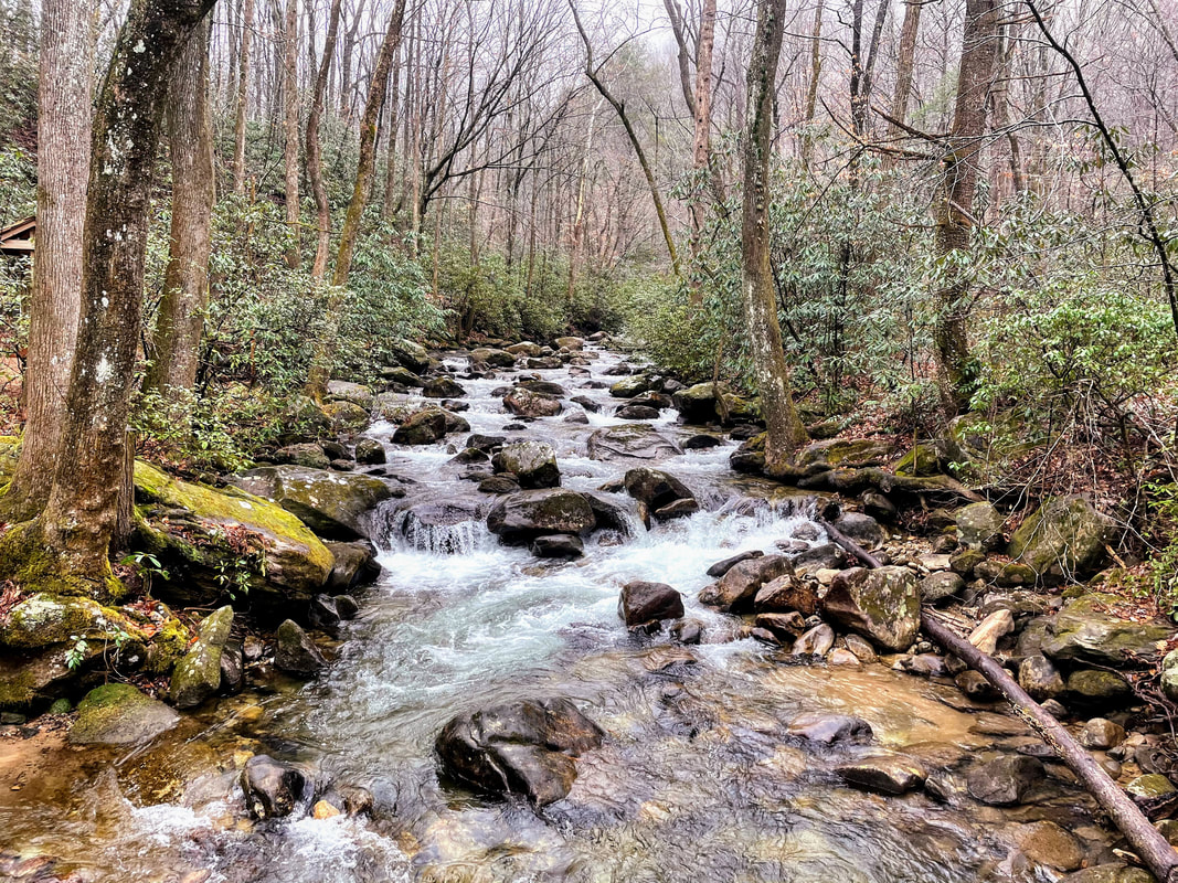 Park Overview: Jones Gap State Park, located just a little over two hours from Charlotte, has been my favorite South Carolina State Park visit so far. Overflowing with rhododendron bushes lining the trails and a gushing river snaking through the woods, Jones Gap is stunningly beautiful and it is easy to see that natural beauty no matter what season it is. Located close to Caesar's Head State Park, the two parks share some common ground, forming the Mountain Bridge Wilderness Area. The trails allow hikers to travel between the two parks, as well as connecting to the Foothills and Palmetto trails. The Middle Saluda River is the state's first designated scenic river, and it's not hard to see why. You can even reserve a riverside campsite, taking in the calming water sounds all night long. After seeing the article on Only In Your State, we decided to hike to the hidden waterfall, Rainbow Falls, a moderately rated trail 2.5 miles one way. Littered with bridges and rocky water crossings, this trail will keep you on your toes. The last 1.6 miles is uphill, with steps and rocks to climb up. The average hiker will take 4-6 hours to complete. Need to Know: Admission: $6 adults; $3.75 SC seniors (age 65 & older); $3.50 children ages 6-15; ages 5 and under, free. Hours: M-Su 9 a.m. - 9 p.m., daily, during daylight savings time and 9 a.m. - 6 p.m., daily, the remainder of the year. Trails close one hour before dark, year round. Camping: Yes 2 Scenic Waterfalls 60+ miles of hiking trails  Visiting the Equator is somewhat of a novel idea and a fun activity to do, but it especially makes sense to do so in Ecuador, which actually translates to equator. Ecuador's capital city of Quito is one of the highest capital cities in the world, located at 9,350 feet above sea level, and is the closest capital city to the equator. Ecuador takes great pride in having such a strong claim to the equator and has gone to great lengths to ensure a satisfying experience when visiting this imaginary line. The Mitad Del Mundo monument is a 100-foot tall building created in dedication to the location of the equator. Surrounding this monument is somewhat of a small village, filled with shops, food, and even a museum. All of this was built to celebrate Ecuador's proud relationship with the equator, but what's truly ironic is that this structure and small town were actually constructed about 800 feet off of the actual coordinates of the position of the equator. While the reasons for the slightly askew monument are a bit unclear, the immense pride of the Ecuadorian people and their love for the equator remains stronger than ever. 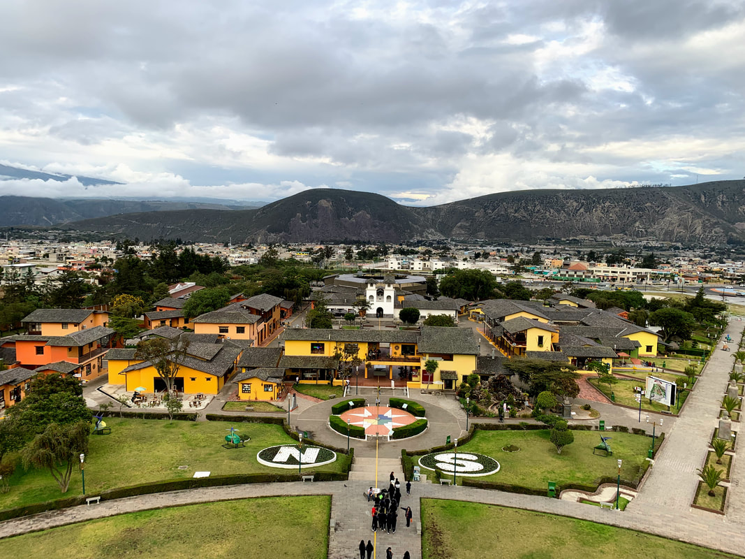 Visiting Mitad Del Mundo, or Middle of the World, whether it is the true equatorial location or not, is a cool experience. From balancing eggs on nail-heads to getting your passport stamped, browsing through the museum and learning about the history of Ecuador, and grabbing some delicious ice cream (remember it's hot at the equator), there is something for everyone! If standing in two different hemispheres at once really excites you, you do not want to miss this. If you do want to visit the other equator, just walk a few blocks, roughly four minutes, down the road to Museo Intiñan. Unfortunately we were not able to enter as we arrived too late, but it look pretty fascinating from the outside. 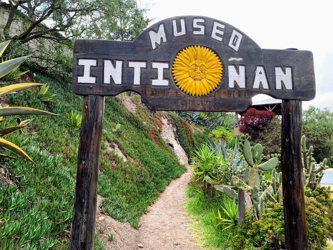 |
AuthorI like hidden gems, hole-in-the-walls, and offbeat destinations Archives
April 2021
Categories
All
|


 RSS Feed